The Power of Stereo Satellite Imagery
Stereo imagery is officially live on the SkyFi app. Access to stereo data unlocks a whole new dimension in the world of remote sensing, offering unprecedented insights into our planet's landscapes.
Introducing Stereo Satellite Imagery
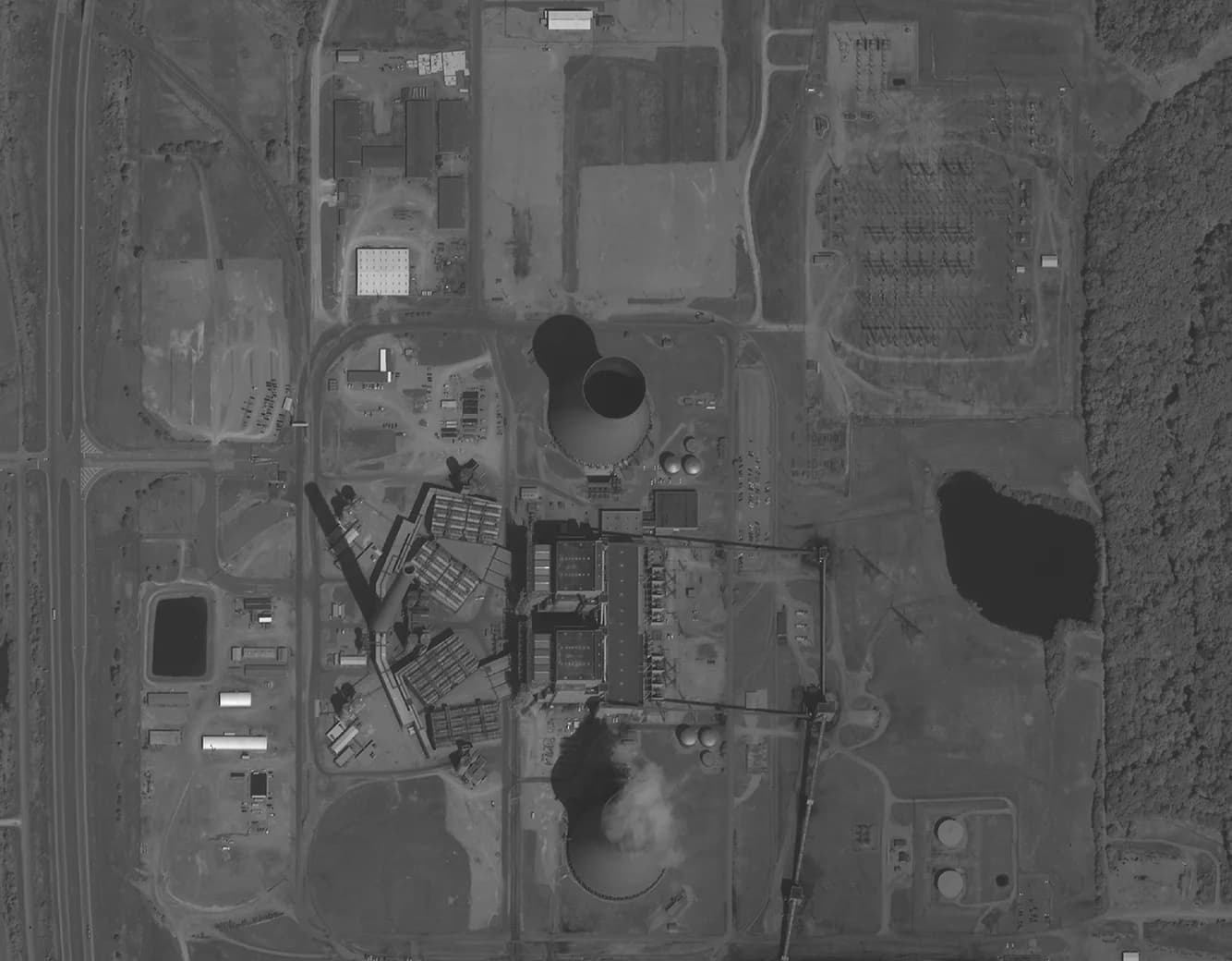
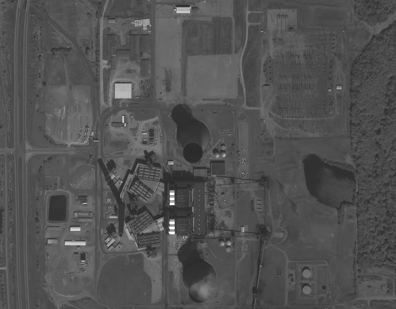
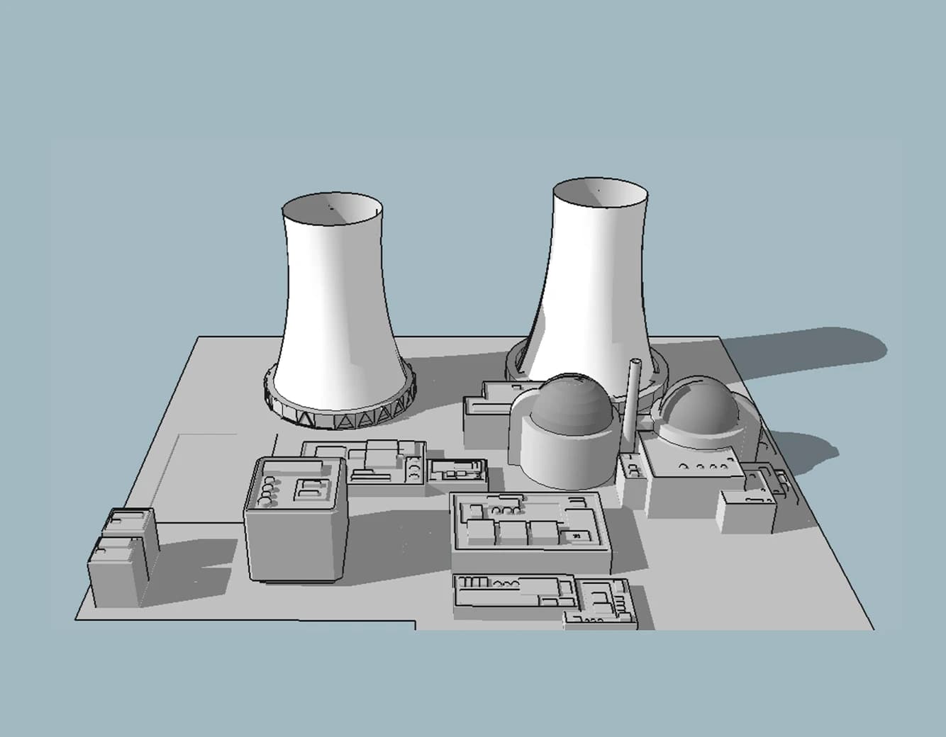
Stereo satellite imagery captures the Earth's surface with two images, providing a stereoscopic view that enables the creation of 3D models and precise elevation data. Unlike traditional optical imagery, stereo imagery utilizes overlapping images taken from different positions, enhancing depth perception and enabling advanced analytical capabilities.
How Stereo Satellite Imagery Works:
Stereo satellite imagery relies on two fundamental components:
Satellite Sensors: Satellites that capture stereo imagery are equipped with sophisticated sensors that capture imagery with exceptional clarity. These sensors have the capability to capture images with resolutions as fine as 50 cm and 30 cm, ensuring a vividly detailed representation.
Overlapping Image Pairs: The magic of stereo imagery lies in the overlapping image pairs taken from two different perspectives. This creates a parallax effect, allowing for the extraction of depth information and elevation data when processed together.
By coming together, these two components form a powerful tool that revolutionizes the way we observe and analyze the Earth's surface.
Use Cases for Stereo Satellite Imagery:
Urban Planning and Infrastructure Development:
Stereo imagery offers urban planners and architects the ability to use specialized programs to create detailed 3D models of cities and towns. By simulating potential construction scenarios and visualizing how new infrastructure will fit into existing environments, stakeholders are enabled to make better informed decisions that optimize space usage and minimize environmental impact. Additionally, stereo imagery gives urban planners the ability to create enhanced flood models for more accurate and detailed simulations of potential flood scenarios, better risk assessment, and improved disaster preparedness measures.
Environmental Monitoring and Conservation:
For environmentalists and conservationists, stereo imagery provides invaluable insights into natural habitats and ecosystems. The technology aids in monitoring deforestation, assessing changes in vegetation cover, and analyzing land use patterns to support sustainable conservation efforts.
Disaster Response and Management:
During times of natural disasters, such as earthquakes, floods, or wildfires, stereo satellite imagery becomes a critical tool for emergency responders. The 3D models generated from stereo imagery provide rapid assessment of affected areas, aiding in disaster response planning and effective resource allocation.
Agriculture and Precision Farming:
Stereo imagery empowers farmers with detailed crop health analysis and terrain mapping. By identifying crop stress, monitoring growth patterns, and detecting irrigation issues, farmers can optimize their practices and maximize crop yield while minimizing resource usage.
Archaeological Exploration:
For archaeologists and historians, stereo imagery offers a new perspective on exploring ancient sites and uncovering hidden structures beneath the Earth's surface. The ability to visualize the landscape in 3D advances the reconstruction of historical sites and the better understanding of ancient civilizations.
While many of these use cases may overlap with optical imagery, here are some specific clues that stereo imagery can better meet your needs:
Need for 3D Information: If the project requires accurate 3D information and elevation data, stereo imagery is the preferred choice. It allows for the creation of detailed 3D models, which are invaluable for urban planning, infrastructure development, and terrain analysis.
Precise Measurements: When precise measurements of height, distance, and volume are crucial, stereo imagery excels. Applications like monitoring stockpile volumes, building heights, and canopy height in forests benefit greatly from the 3D capabilities of stereo imagery.
The introduction of stereo satellite imagery at SkyFi marks a significant milestone in the field of remote sensing. By enabling 3D visualization and precise elevation data, this advanced technology opens up a plethora of possibilities for various industries and applications. Whether it's urban planning, environmental monitoring, disaster response, agriculture, or archaeology, stereo imagery enriches our understanding of the world and empowers us to make informed decisions for a sustainable future. Embrace the power of stereo imagery today and unlock a new dimension of insights at your fingertips!


