SkyFi App Now Offers Very High Resolution Imagery
Introducing Very High Resolution Imagery on SkyFi
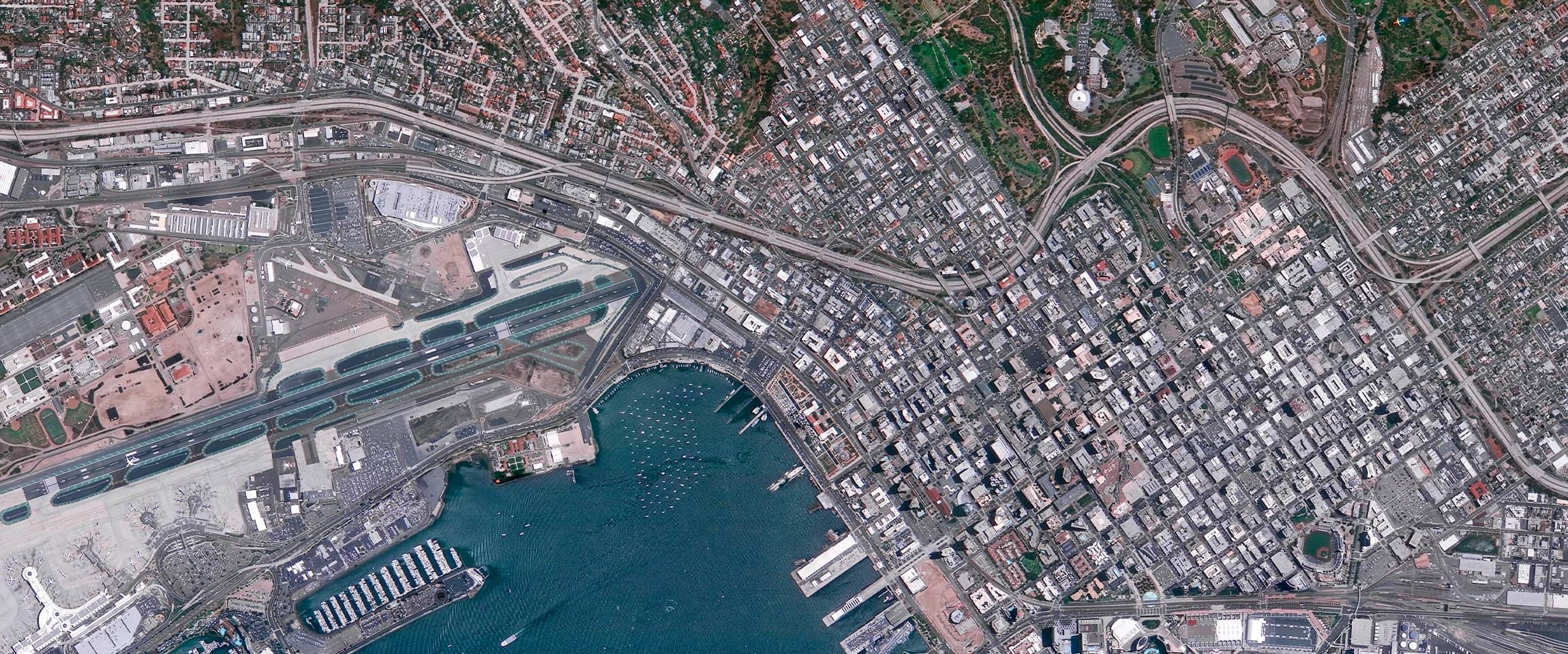
Very High Resolution imagery is available on the SkyFi app! You can now acquire satellite imagery with resolutions ranging from 31-50 cm for both Optical and SAR sensors. Existing Very High Resolution Optical imagery is also available, providing users with a wealth of data to work with. This upgrade from our High Resolution imagery will allow users to access clearer and more detailed images, resulting in more data and better insights.
Meeting the Demand for Higher Resolutions
This expansion of our offerings is a direct response to the demand for higher resolutions from users who require detailed images to carry out their work effectively. With the inclusion of Very High Resolution data, SkyFi users can now access an unprecedented level of detail, providing you with the necessary tools to make informed decisions and tackle real-world problems.
Applications in Multiple Industries
Access to both SAR and Optical Very High Resolution (VHR) data on SkyFi's app will significantly benefit users in many industries. For example, in agriculture, VHR data can be used to identify areas of stress in crops, monitor soil moisture levels, and detect pest infestations. Environmental monitoring can benefit from VHR data by providing detailed information on land use changes and habitat loss. Defense and security can utilize the data to identify potential threats and monitor areas of interest.
Satellite Imagery Solutions
At SkyFi, we are committed to providing our customers with the most advanced satellite imagery solutions on the market. With the release of our Very High Resolution satellite imagery, we are taking a major step towards helping you make data-driven decisions.


