Elevate Decision Making with SkyFi Insights
SkyFi Insights is your gateway to the future of smart resource allocation. Experience the power of SkyFi Insights where a community of experts fuel our analytics tools, delivering practical intelligence with speed and ease.
ENTER SKYFI INSIGHTSSkyFi Insights redefines the speed and simplicity of Earth observation analytics. Our user-friendly platform streamlines the process, breaking down complex data into easily digestible answers. We know that the world is always evolving, and so do SkyFi Insights. We are actively integrating new Insights to the platform, so that you can tackle your ever-changing world of questions.
Near Real-time Resource Optimization:
Make informed decisions to optimize resource allocation backed by near real-time and accurate Earth observation data.
Competitive Advantage:
Staying ahead of market trends, SkyFi Insights unlock new avenues for innovation and capitalize on emerging opportunities, securing your position as industry leaders.
Customized Expertise:
With SkyFi Insights, you gain access to a constantly expanding pool of industry-specific experts. We integrate the latest talent, ensuring you receive tailored solutions for every challenge within your world.


On-Demand Geospatial Answers
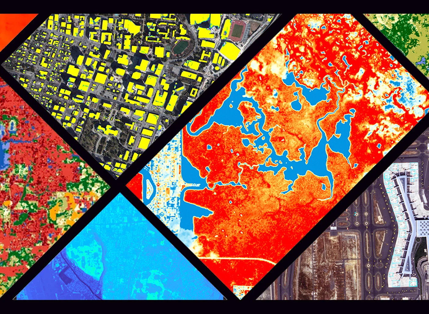
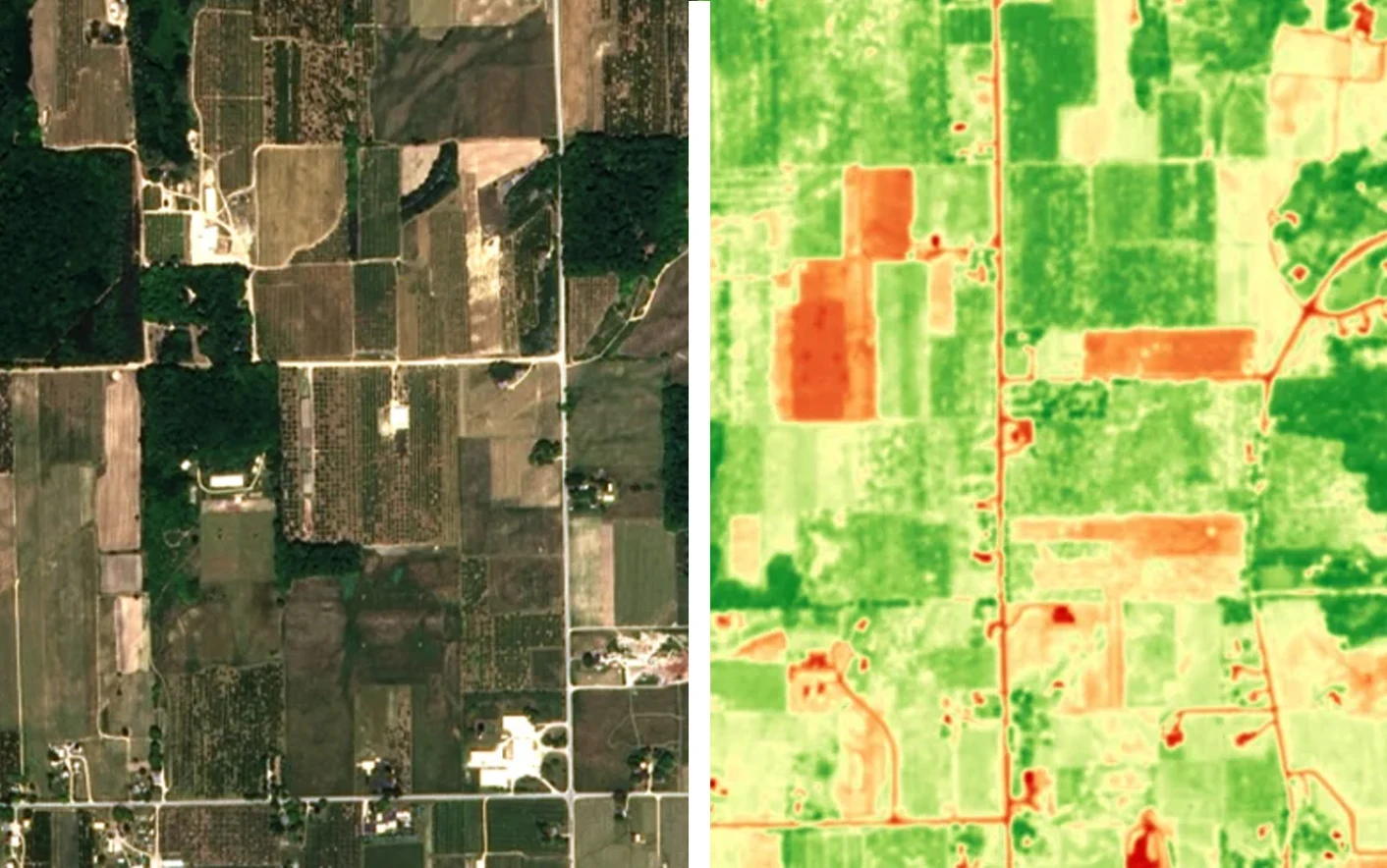
NDVI For Vegetation Health
Use NDVI analysis, derived from Earth-observation imagery, to monitor crop health, predict yields, optimize irrigation and agrochemicals, detect stress early, and enhance resource allocation. This data-driven approach revolutionizes farming, maximizing yields, minimizing losses, and promoting sustainability.
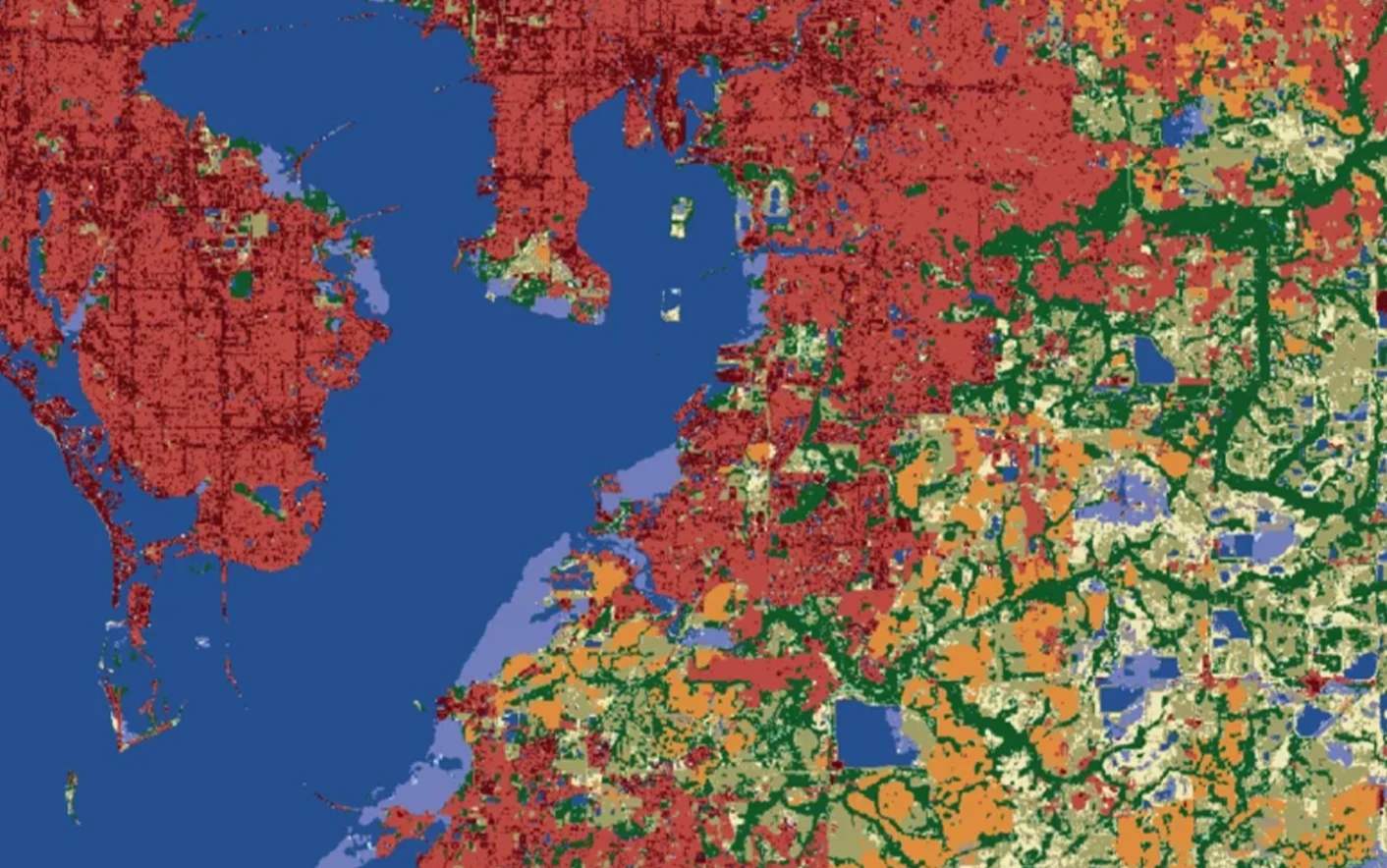
Land Use Map Bundle
Access the Land Use Map Bundle for environmental intelligence, urban planning, and disaster management. Get 14 land cover classes in your area of interest (AOI), including water, trees, rangeland, crops, and more. Analyze changes over time with a one-year comparison map. 3-day delivery ensures timely data for informed decisions. The Land Use Map Bundle by Impact Observatory gives you a visual understanding into your world, so you can make better decisions.
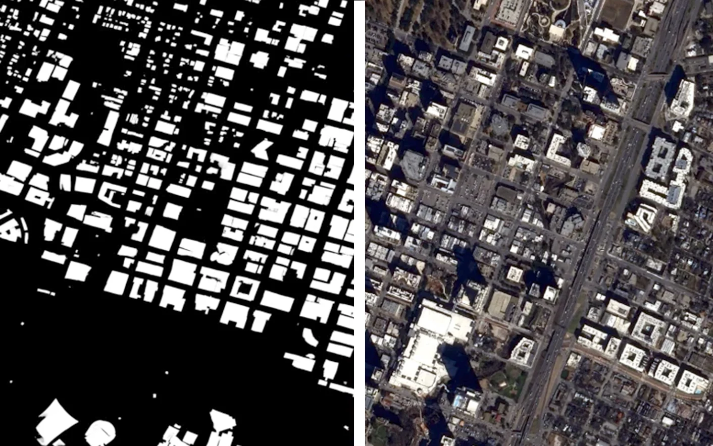
Building Footprint Highlights
Tap into the power of of satellite-based building detection algorithms to revolutionize urban planning for sustainable growth. With accurate mapping, urban growth analysis, optimized land use, and enhanced disaster preparedness, this Insight empower city planners to shape vibrant, resilient cities for the future.
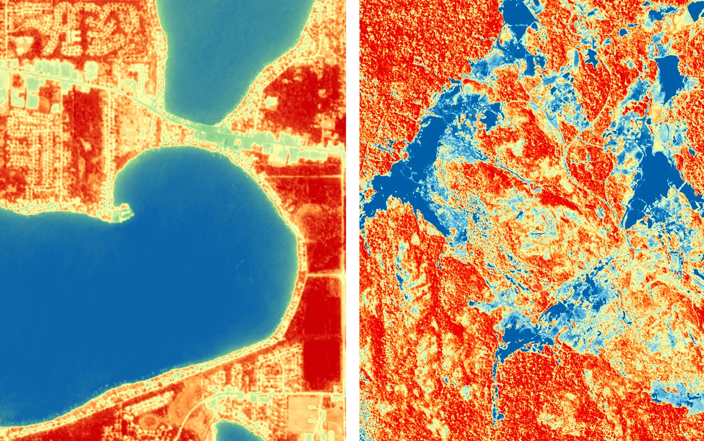
NDWI For Standing Water
Leverage the advantages of NDWI analysis for mapping and monitoring flood-prone areas. By analyzing historical and real-time NDWI imagery, flood events can be detected and tracked. The Insight highlights areas with increased water content, indicating potential flood zones. Continuous monitoring of NDWI values allows for early warning systems, enabling timely evacuation plans and resource allocation during flood events.
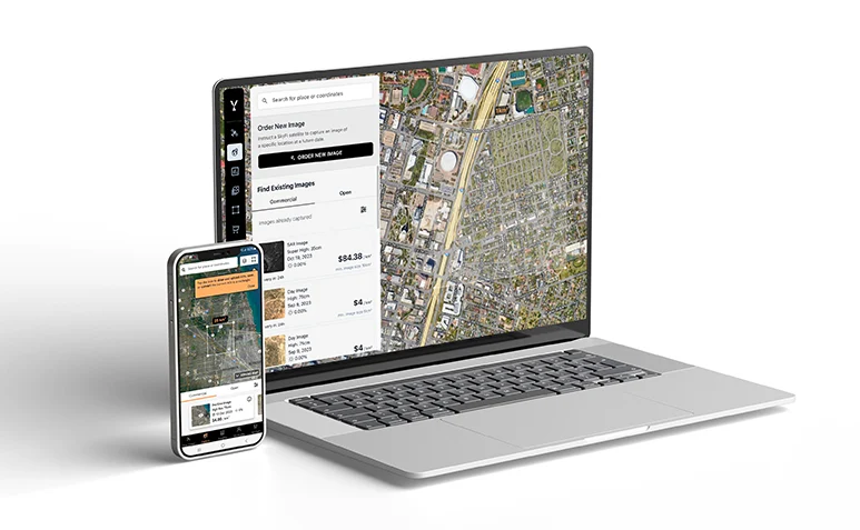
Easifying Access To Satellite Imagery No Longer Just for the 1%
IN UNDER 24 HOURSSingle Archive Image
STARTING AT
$
20
*High-resolution daytime image
Single Tasking Image
STARTING AT
$
175
*High-resolution daytime image
Connect to our API to get direct access to all of the resolutions, product types, and capabilities needed to enhance your data operations.
Start Exploring Now
- 01Sign up
Create your FREE account today.
- 02Explore immediately
Get immediate access to our user-friendly interface and start exploring anywhere on the planet with transparent pricing options upfront.
- 03Place an order
Order open data for free and receive it via email shortly after your order. Order open data for free and receive it via email shortly after your order. You can also purchase new or existing commercial imagery.
SkyFi is easifying the world of Earth observation and data analytics. Using our intuitive app, you can access vast archives of imagery or capture new, bespoke images from satellites, planes and more. But we don't stop there. SkyFi Insights translates the wealth of data within these images into clear, actionable intelligence. Now, complex data analytics is as easy as clicking a button and as affordable as ever. Welcome to the new era of Earth data.