Choosing Your Satellite Sensor
What is a satellite sensor?
A satellite sensor is a device or instrument mounted on a satellite that is designed to detect and measure different types of energy and signals from the Earth's surface and atmosphere. These sensors can capture various types of data, such as imagery, temperature, and radiation, and transmit it back to Earth for further analysis. The sensor in a satellite ultimately determines the type of data that the satellite detects. It’s critical to understand which type of data you need for a given use case as different types of sensors are used for different purposes, depending on the intended application.
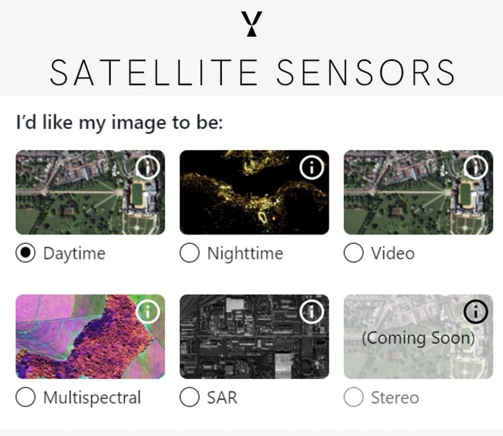
What sensors does SkyFi offer?
Optical Sensors: Optical sensors capture images of Earth during daylight hours, much like what you’d expect to see in a standard photograph. Our current daytime sensor resolutions include high (between 50 and 100 cm) and medium (5m). Daytime captures can be used to monitor things like vegetation, water resources, construction, and land use changes. Nighttime Sensors: Nighttime sensors capture images of Earth during nighttime hours. They are primarily used for observing human activity and natural phenomena that occur at night, such as city lights, auroras, and wildfires. Nighttime sensors can also be used to study atmospheric phenomena, such as air pollution and cloud cover. Multispectral Sensors: Multispectral sensors capture images of Earth in different spectral bands, including visible, near-infrared, and thermal wavelengths. They can provide detailed information on vegetation health, land cover, and oceanic conditions. Multispectral sensors are particularly useful for monitoring changes in the environment over time, such as deforestation and drought. Video Sensors: Video sensors capture a continuous stream of images, which can be used to create videos of Earth’s surface. Our current video sensors provide a total of 288 frames at 10 frames per second. They can provide a real-time view of the environment, making them useful for tracking changes and monitoring events as they unfold. Video sensors can be used for a variety of applications, such as disaster monitoring, traffic surveillance, and security. Synthetic Aperture Radar (SAR) Sensors: SAR sensors emit microwave energy and measure the reflected energy to create images. They can penetrate clouds and provide high-resolution images of the Earth’s surface, even in the absence of visible light. SAR sensors are particularly useful for mapping and disaster monitoring, especially in cloudy places. They can also be used to detect changes in the Earth’s surface, such as movement of glaciers and earthquakes. It is important to note that current SAR images are limited to acquiring one polarization of data, meaning that the resulting image is visualized as black and white. Understanding the capabilities and limitations of different satellite sensors is critical for selecting the right data for a given use case. Each sensor type provides unique benefits and insights, from monitoring vegetation health and land cover changes to observing human activity at night or tracking disasters. By leveraging these different sensor technologies, SkyFi is helping its users gain a deeper understanding of our planet and drive innovation in fields such as agriculture, urban planning, and environmental management.