OCTOBER 13
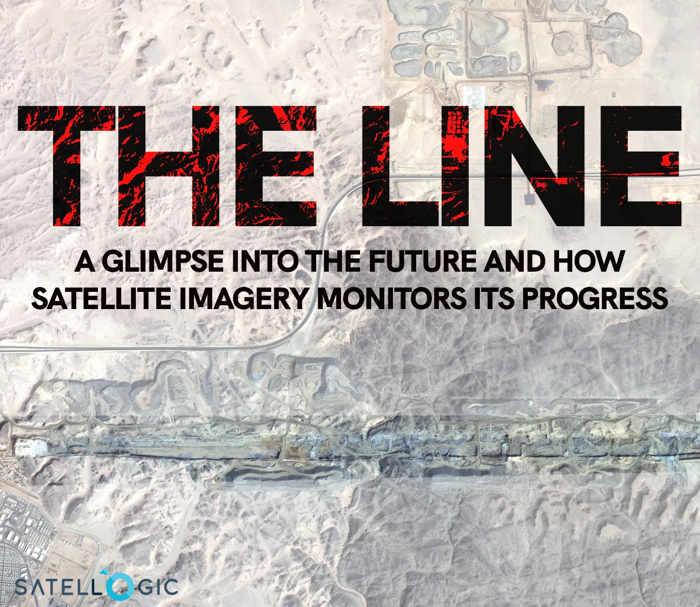
The Line in Saudi Arabia: How Satellite Imagery Monitors Its Progress
Saudi Arabia's ambitious urban project, "The Line", is an embodiment of the futuristic vision for sustainable living and transport. This city, planned as part of the broader "NEOM" economic zone, presents a unique linear urban model. It’s not just its architectural novelty that captures the world's attention but also the innovative methods for monitoring its construction, such as satellite imagery. In this article, we delve deep into the significance of The Line and how satellites aid in keeping a tab on its development.
The Power of Open Data and Satellite Imagery
Before we dive into the details of 'The Line,' it's crucial to understand the role of open data and satellite imagery in this project. The availability of free, high-resolution satellite imagery has been a game-changer in modern construction and urban planning. Open data is available for free on SkyFi and is updated every five days, enabling researchers, urban planners, and even the general public to monitor projects like 'The Line.'

Now, let's explore the fascinating aspects of 'The Line' and how satellite imagery plays a pivotal role in shaping its future.
What is 'The Line'?
The Line is a revolutionary urban development project in Saudi Arabia, conceived as a 170-km city built in a straight line. It aims to challenge traditional urban living by ensuring that essential facilities are within a five-minute walk for all residents, and notably, eliminating the need for cars or roads.
Key features of 'The Line':
1. Zero Carbon Emission: The city is designed to run on 100% renewable energy.
2. Innovative Transport: With the absence of cars, the main mode of transportation will be high-speed transit and autonomous mobility solutions.
3. Pedestrian Focus: The Line promises all daily needs within a five-minute walk, supporting a pedestrian-centric urban lifestyle.
4. Integration with Nature: The design ensures minimal environmental impact, preserving 95% of nature within the NEOM zone.
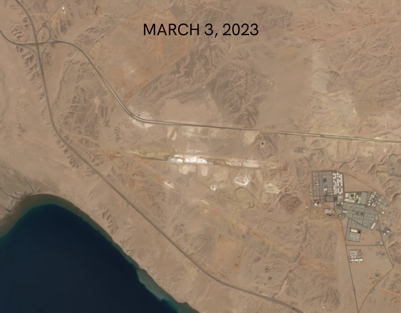
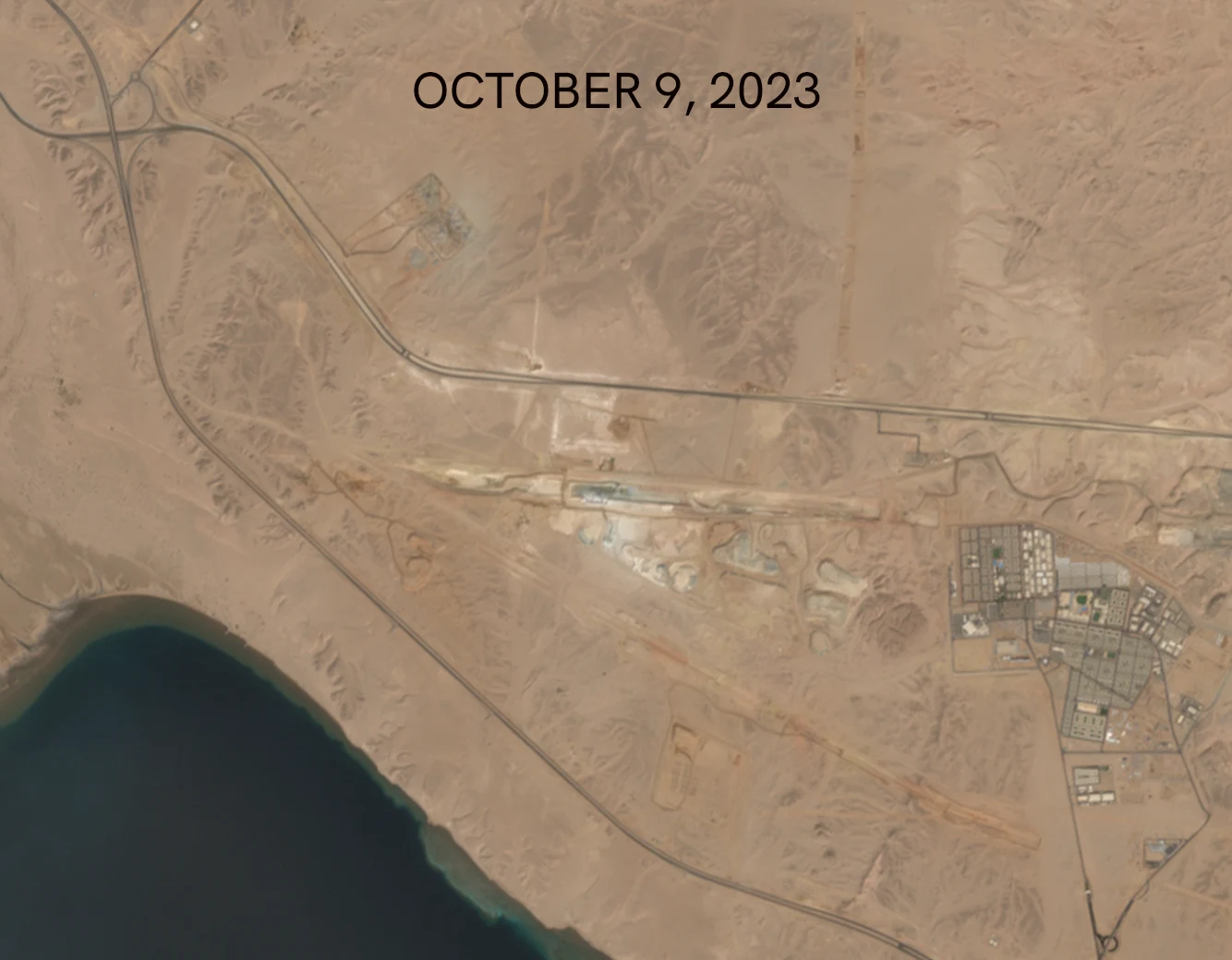
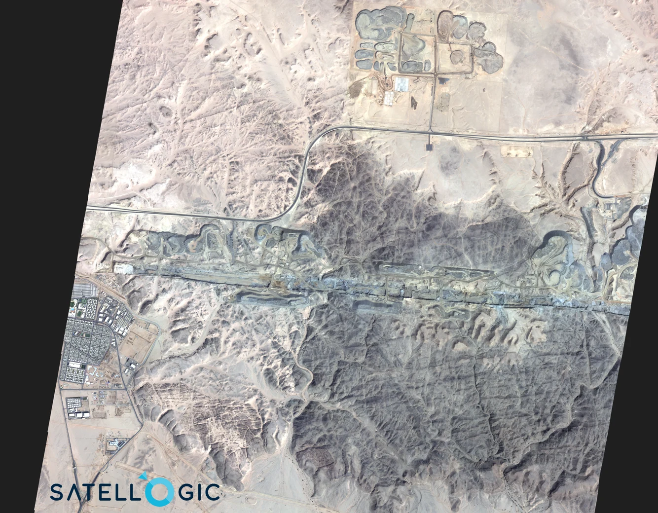
Satellite Imagery and Construction Monitoring
The construction of such a massive and unprecedented project demands meticulous planning and surveillance. Enter satellite imagery.
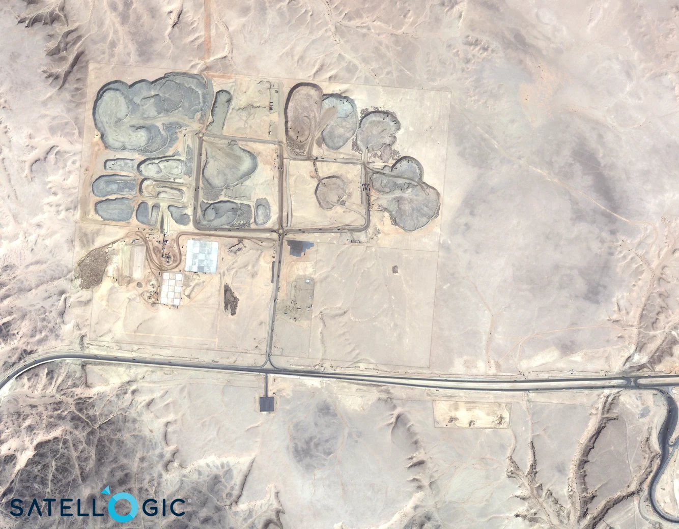
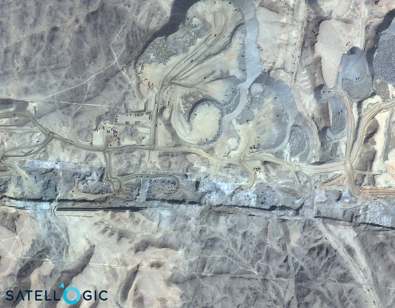
The image above was taken by our partner Satellogic's constellation on October 7, 2023. You can order new images from Satellogic through SkyFi here.
Here's how satellite imagery is playing a vital role in monitoring The Line's construction:
1. Real-time Monitoring: Satellite images can provide frequent updates on construction progress. It helps authorities to ensure that the development is on track and adheres to the planned timeline.
2. Topographical Analysis: Before construction began, satellite imagery was instrumental in analyzing the terrain, understanding its nuances, and planning the construction accordingly.
3. Environmental Impact Surveillance: Satellite images offer insights into how the construction impacts surrounding ecosystems, ensuring that The Line remains true to its eco-friendly goals.
4. Resource Management: Using satellite data, project managers can keep tabs on the transportation of materials, manpower allocation, and infrastructure development.
5. Infrastructure Integrity: The Line's integrity, especially its transportation tunnels and other foundational structures, can be assessed via satellite-based radar systems that measure minute ground displacements.
6. Data Sharing with the Public: Periodic satellite images can be shared with the public to maintain transparency regarding the project's progress and its environmental impact.

The Future of 'The Line’
Once complete, The Line stands to be a testament to sustainable urban development. It envisions a harmonious coexistence of humanity and nature, without compromising the modern conveniences that we've come to depend on.
This linear city also serves as a blueprint for future urban development projects worldwide. As cities grapple with overpopulation, traffic congestion, and environmental degradation, The Line offers a fresh perspective on how urban centers can evolve.
The Line in Saudi Arabia is not just another construction project; it's a reimagining of what urban life can be. With satellite imagery playing a crucial role in monitoring and ensuring the project's success, we're witnessing the fusion of advanced space technology and ground-breaking architectural vision. As The Line progresses, it will be fascinating to watch how it reshapes urban planning paradigms across the globe.