Satellite-Based Building Detection Algorithms: Transforming City Planning for Sustainable Growth
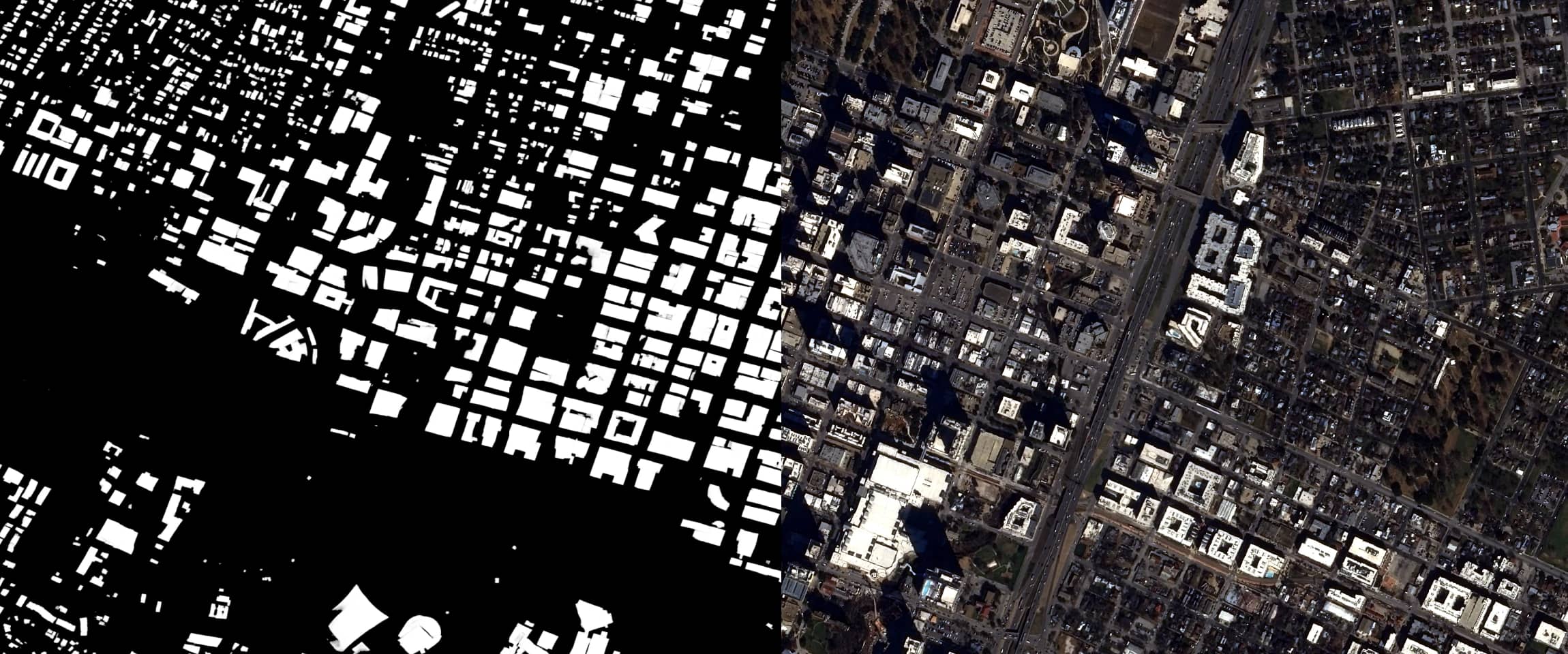
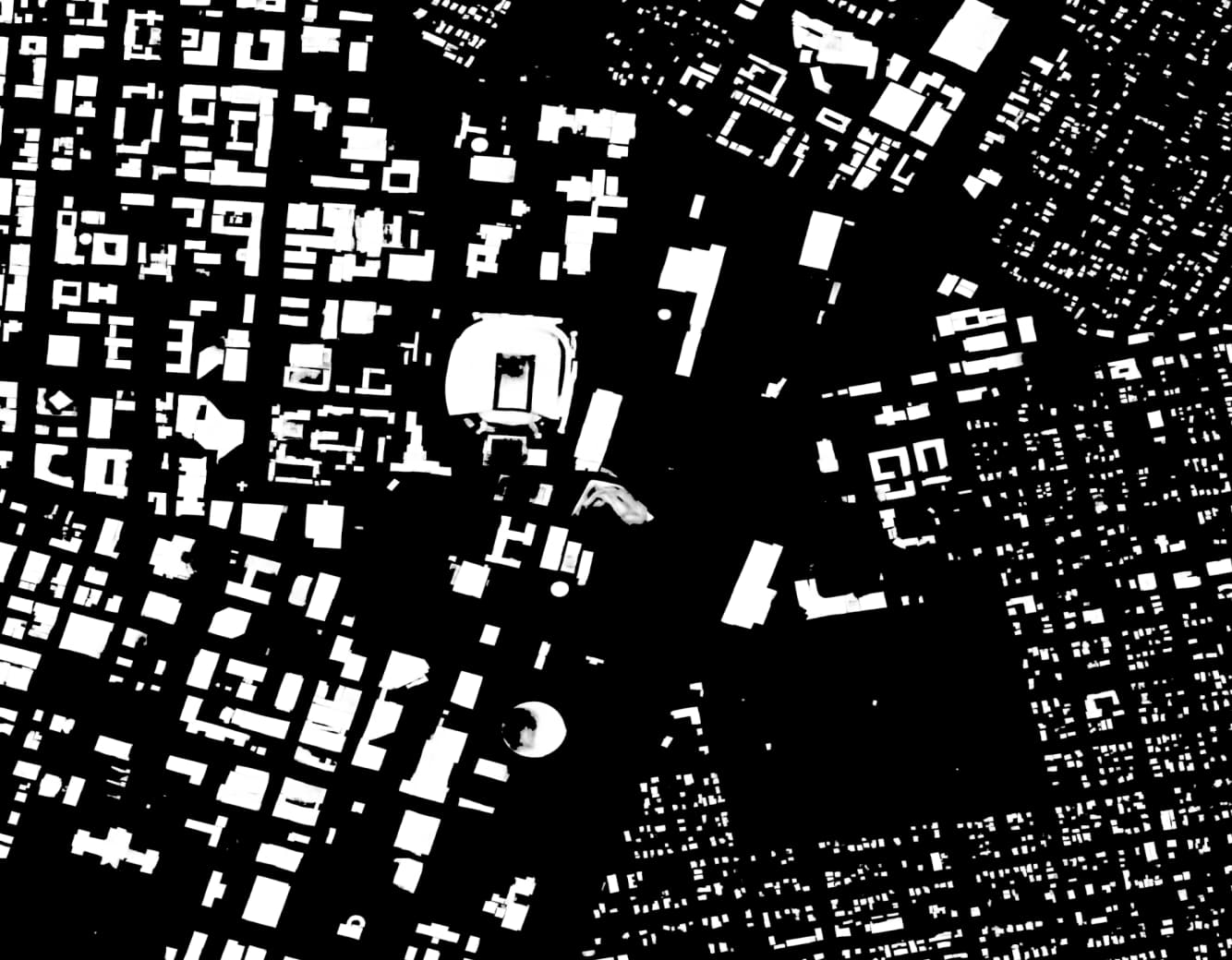
In an era of rapid urbanization, city planners face the complex task of managing urban growth while ensuring sustainable development. To address this challenge, Earth observation imagery coupled with advanced building footprints algorithms has emerged as a powerful tool for city planners. These algorithms enable the identification and analysis of buildings on a large scale, providing invaluable insights for urban planning, infrastructure development, and sustainable growth
Accurate Mapping of Urban Infrastructure
Building detection algorithms leverage high-resolution satellite imagery to accurately map urban infrastructure. By automatically identifying and delineating buildings within a city, planners can generate comprehensive building inventories and geospatial datasets. This information assists in assessing the current distribution, density, and types of buildings, which in turn guides infrastructure planning, zoning regulations, and land-use management.
What industries use building detection?
Urban Growth Analysis
Building detection algorithms facilitate the analysis of urban growth patterns over time. By comparing historical imagery, planners can observe changes in building footprints, identify areas of significant growth, and monitor the expansion of urban areas. This data-driven approach provides insights into the dynamics of urbanization, enabling city planners to make informed decisions regarding future growth, transportation infrastructure, and the allocation of resources in line with sustainable development goals.
Infrastructure Planning and Resource Allocation
Efficient infrastructure planning is crucial for sustainable urban development. Building detection algorithms assist city planners in identifying areas with high building densities or insufficient infrastructure. By mapping the distribution of buildings, planners can strategically allocate resources for transportation networks, utilities, schools, hospitals, and other public amenities. This proactive approach helps optimize infrastructure investments, enhance service delivery, and ensure equitable access for residents across the city.
Land-Use Optimization
Building detection algorithms contribute to optimizing land-use patterns within cities. By analyzing building footprints and their associated functions, city planners can evaluate land-use efficiency, identify underutilized areas, and guide urban regeneration efforts. This information enables the repurposing of vacant or derelict spaces, promoting sustainable redevelopment, and minimizing urban sprawl. Optimizing land-use allocation helps create vibrant neighborhoods, enhance livability, and preserve green spaces, fostering a more sustainable and inclusive urban environment.
Disaster Preparedness and Resilience
Building detection algorithms aid in assessing vulnerability and enhancing disaster preparedness in urban areas. By identifying building types, materials, and structural characteristics, planners can evaluate the resilience of the built environment to various hazards such as earthquakes, floods, or fires. This knowledge supports the development of targeted mitigation strategies, emergency response plans, and the implementation of building codes and regulations to enhance urban resilience and safeguard the well-being of residents.
Powered by satellite imagery, building detection algorithms have transformed city planning processes, enabling planners to analyze and plan for sustainable growth. By accurately mapping urban infrastructure, analyzing urban growth patterns, optimizing land-use, and facilitating informed decision-making, these algorithms support city planners in creating resilient, efficient, and livable cities. Embracing satellite-based building detection algorithms empowers city planners to shape urban development in a sustainable and future-oriented manner, ensuring the well-being of residents and fostering thriving urban environments for generations to come.