Satellite Images vs. Aerial Images: Different Technologies, Different Applications
If you’ve ever zoomed in on Google Maps to get up close and personal with downtown Paris or virtually cruised the Las Vegas Strip from high above on Google Maps, you’ve probably been awed by the clarity of the images. How can a satellite produce such pristine images from hundreds of miles out in space?
The short answer? They can’t.
In A Nutshell: Satellite Images Have a Wider Field of View but Less Clarity
Aerial imagery, like most of the best quality images on Google Maps, and satellite imagery are two different types of data that have their own benefits and drawbacks. SkyFi is currently focused on making satellite imagery more affordable and accessible to the average consumer through our mobile and web applications, even though aerial imagery will soon find a home on our platform, as well.
Understanding the Differences Between Aerial and Satellite Imagery on Google Maps
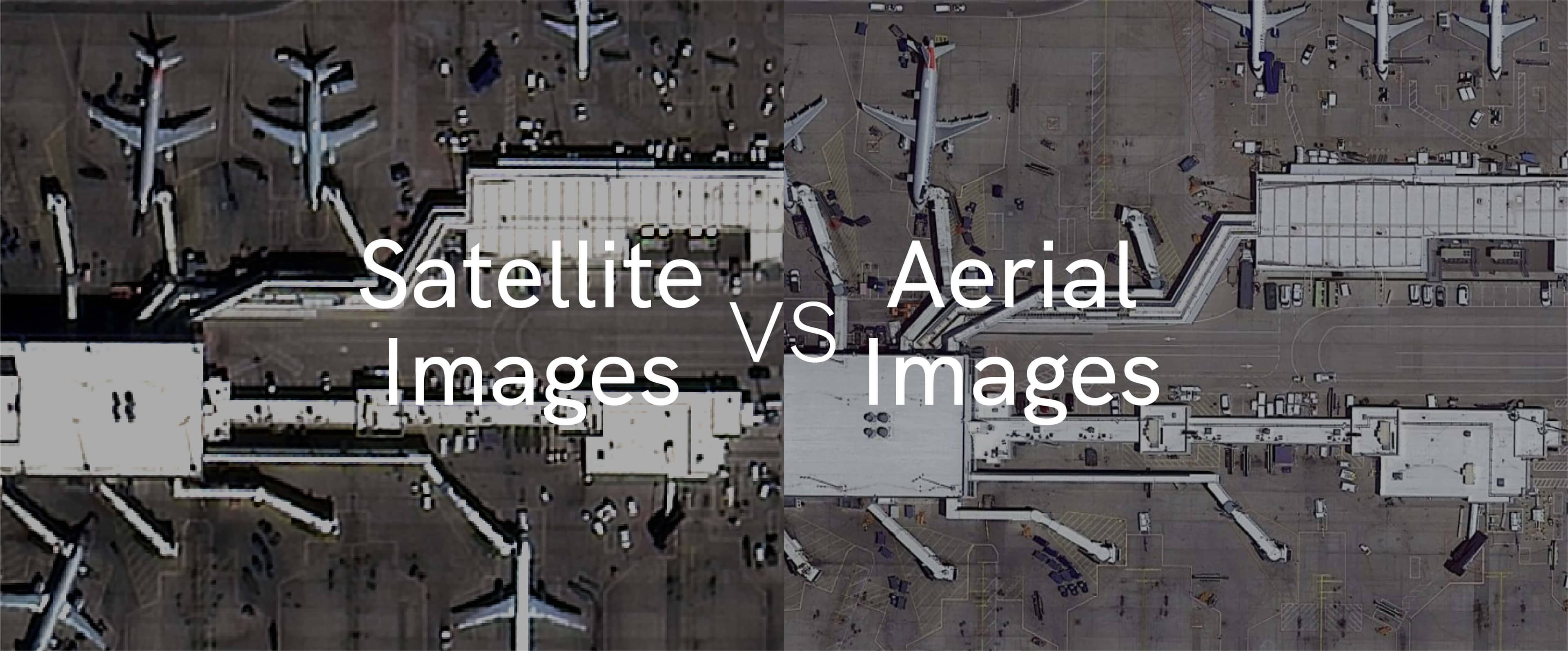
Regardless of how Google Maps labels them, only the widest-angle shots use satellite images. On images showing continents and states, you’ll see government satellites such as Landsat or Copernicus listed among the sources Google credits for the stitched-together pictures it displays. As you zoom in, Landsat disappears from the credits when the image covers about 40 miles in width – about the size of Oahu, Hawaii. The University of Virginia explains that “in both Google Maps and Google Earth you’ll see a copyright notice along the bottom of the screen identifying Google’s imagery source. This notice changes as you zoom in according to the imagery resolution provided by each vendor.” Get closer, and all third-party sources fall off the credit list, leaving only Google. This is where aerial photography takes over.
The highest-resolution pictures – shots where you can count each individual tree in a grove or each iron beam in the Eiffel Tower – are taken from much closer to the ground than satellites. Aerial images are photographs snapped from airplanes, drones, balloons, and even kites passing or hovering only a few hundred to several thousand feet above the surface of the earth. This proximity to their subjects allows high-clarity shots that look beautiful on your computer or cell phone screen.
True satellite imagery obtained from sensors orbiting 300 to 400 miles (~475 to 650 km) above Earth are not intended to match the resolution that aerial photography can manage, as satellites by their nature have a much larger field of view than aerial sensors. Think of it this way: if you go to an art museum and stand next to a painting, you will be able to make out every detail. Take a few steps back and you can see the gallery wall but not each painting as clearly. Back up even further and you can see a gorgeous collection but you won’t be able to study the brushstrokes. With imagery, the detail that can be represented by each pixel changes based on your distance, field of view, and atmospheric factors, meaning aerial data quality will surpass satellite imagery in most circumstances.


