How Journalists Can Benefit From Near Real-Time Satellite Imagery
Among a seemingly indecipherable hurricane of disinformation, declining media literacy, threats to press freedoms, the rapid and memetic spread of online info, and unprecedented propaganda campaigns, global journalism finds itself at a historic — and vital — crossroads. Now, more than ever, journalists need powerful tools to combat the rising tides of “fake news” and ensure the ongoing availability of verifiable, objective and insightful reporting for everyone. Previously used by production teams to transmit data and stories, satellite technology has long been one of those tools, but the ascendance of accessible, high-quality earth observation imaging will soon make satellites an absolute essential for strengthening vocational values, such as credibility and transparency. Here’s how the democratization of satellite access is poised to change the journalistic landscape for the better.
Credibility and Transparency
Images captured via satellite are more than just a strong visual storytelling aid (though they are certainly that too). Satellite imagery not only serves as a reliable data source for journalists but oftentimes as an irreplaceable primary data source — meaning that the data is original and collected by the journalist firsthand rather than being conveyed by a secondary party. As visual primary sources that are also rich in data, satellite-produced images serve as vibrant records that empower journalists to establish the veracity of their work in a straightforward way. And that’s especially critical in a landscape where online junk data grows ever more viral, as it effectively and immediately builds credibility and transparency between a writer and their audience.
Not only does real-time satellite imagery add a massive new pool of primary sources for journalists to pull from, it can often be used as a corroborating source. In the age of “fake news,” digitally edited footage and deepfakes, forensic analysis of detailed topographic imagery can be used to both confirm and deny doctored footage, to dismiss or verify footage that claims to be from a certain period of time or location, by observing everything from landmarks to time-telling shadows. In journalism, this decisive method is known as “establishing correlations.”
By leveraging satellite imagery, the old adage of “show, don’t tell” gets a whole new lease on life — especially when it comes to data sources. It’s radical transparency in action.
Journalism for the Now
In 2022, satellite imaging tech meets journalism exactly where it lives. Near real-time access to high-definition imagery from any place on the planet (a feature that’s central to SkyFi) enables news to travel at the accelerated speed of today’s information stream. Meanwhile, hyperdetailed aerial views and increasingly easy access to geospatial data accommodate the growing shift toward remote work — which is, for many journalists, a safety issue just as much as it is a convenience issue. With up-to-date satellite images, journalists now have access to near real-time circumstances, remotely, which outright changes the face of field journalism forever.
Data Journalism
Satellite imagery is a pillar of what we now know as “data journalism,” which is the art of relaying stories built on a foundation of number crunching and hard data. Data is a resource that we have more of now than we ever have before; leveraging numerous reliable data sources in an analytical fashion not only helps journos convey meaningful stories, it leads to the types of insights that help society at large crack some of our biggest problems, from environmental issues to human rights crises (more on those insights later).
As the lawyers and technologists at Masaar put it, “Data journalism gives everyone the ability to share information and gain insight. We can better understand the world around us by using numbers and facts. It allows us to discover new trends, issues, and patterns. We also have the power to change things for the better.” As apps like SkyFi put the control of data directly in the hands of working journalists, real-time satellite imagery helps make data journalism available to all.
Applying the Tech
Whether you’re an aspiring journalist or work in investigative, editorial or watchdog fields across just about any number of beats — from environmental to corporate – real-time satellite imagery has the potential to affect journalistic output on a seismic level. Of course, the proof is in the publishing. Here are just a few examples of how modern satellite imaging has not only helped meaningful exposés along but how satellite sources have made them possible at all:
Remote sensing provided the smoking gun for the INK Centre for Investigative Journalism‘s story about misuse of government funds in Botswana, revealing a 15-hectare construction site (complete with a helipad and runway) that the then-president had denied existed at all.
When Russia blamed Ukrainian forces for shooting down a Malaysian Airlines flight, killing 298 passengers, existing satellite imagery purchased by a crowdfunded citizen’s journalist group debunked the lie, proving by comparison that the images Moscow provided as “proof” of innocence had been doctored.
For years, satellite imagery has been a reliable source of information on events transpiring in North Korea, a wholly isolated country, offering insights into everything ranging from military development to day-to-day life, such as the state of housing, electrification and crop growth.
Satellite images were used to estimate crowd counts at the inaugural Women’s March and at various Black Lives Matter protests, now known to be among the largest protests in human history.
During the COVID-19 pandemic, worldwide real-time satellite imagery and geospatial data helped authorities and journalists convey accurate information in key areas related to public health, including population density and pipelines for distributing essential materials for medical response.
More than 30 years’ worth of satellite imagery assisted researchers and environmental journalists in revealing the deforestation of Brazilian rainforests, which play a key role in regulating Earth’s climate.
Analytical Application
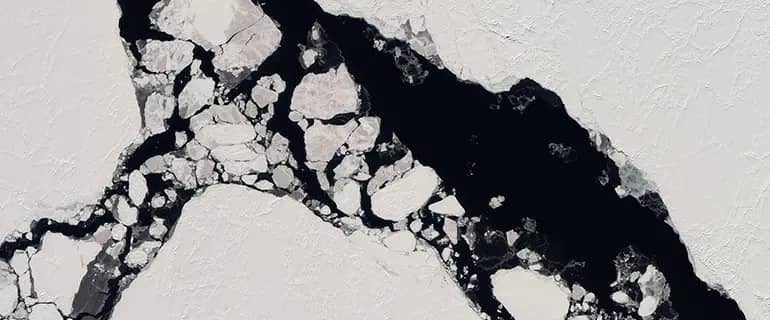
One thing to know about real-time satellite imagery today is that space-based cameras are able to produce high-resolution images — down to 30 centimeters per pixel, in the case of SkyFi — that are extremely rich in large-scale data. With computer-assisted, and increasingly AI-assisted, analysis, these massive macroimages provide journalists with microdata, ranging from human crowd sizes to animal migration numbers. How has vegetation in a given region changed over time? How many soldiers’ boots are on the ground? How quickly is a forest fire moving, and what is its size? What were the traffic conditions in Los Angeles on a specific day? All of this data can be captured by the eyes of orbital cameras then identified and parsed by imaging software that’s faster and more accurate than human eyes. And at the end of this process, a primary source is born.
Redefining Accessibility
It’s true that real-time satellite imagery offers widely expanded access to physically inaccessible areas, such as dangerous war zones or unpredictable climate disasters. That sort of access has been essential for journalists breaking stories ranging from the explosion at the Fukushima nuclear reactor in 2011 all the way up to Russia’s invasion of Ukraine in 2022. But that’s not the end of the story when it comes to satellite tech and accessibility.
Formerly a prohibitively expensive platform virtually exclusive to government organizations and the wealthy, affordable access to high-quality satellite imagery from anywhere on Earth is now easily accessible to the average person (including journalists) due in large part to emerging tech like SkyFi. In the past, high costs, copyright issues and the just plain complicated process of obtaining sensory data have proven to be significant hurdles for news agencies, freelance journalists and organizations with modest budgets. But now that satellite imagery can be reasonably and easily outsourced — and now that said imagery can be purchased at a reasonable price — access to key data has been democratized in a big way.
At the end of the day, journalism is all about access. And just like the best stories our journalists have to offer, real-time satellite data is indisputably up to date, continuous and — maybe most importantly — completely unbiased.
Sources
Reuters Institute — Satellite Journalism - The Big Picture
Columbia Climate School — How Journalists Can Track Down Great Satellite Images in Real Time
Geospatial World — Satellite Imagery for Journalism: Why a Picture Is Worth a Thousand Words
Quill — Eyes in the Skies: Getting the Most Out of Satellite Data and Images
Masaar — Why Is Data Journalism More Important Than Ever?
CNN — New Satellite Imagery Shows Activity at North Korean Underground Nuclear Test Site