Now Available: 30 cm Imagery on SkyFi
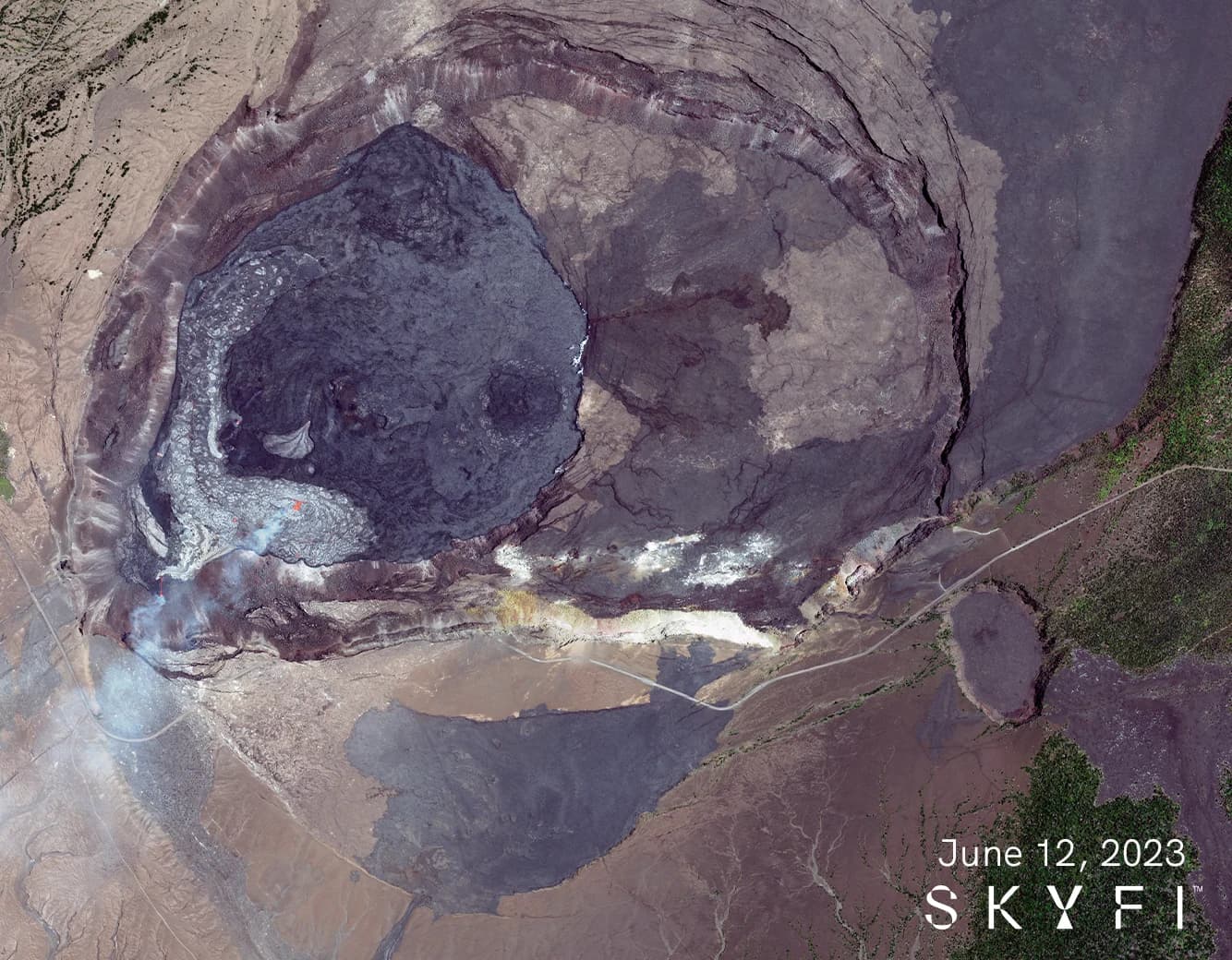
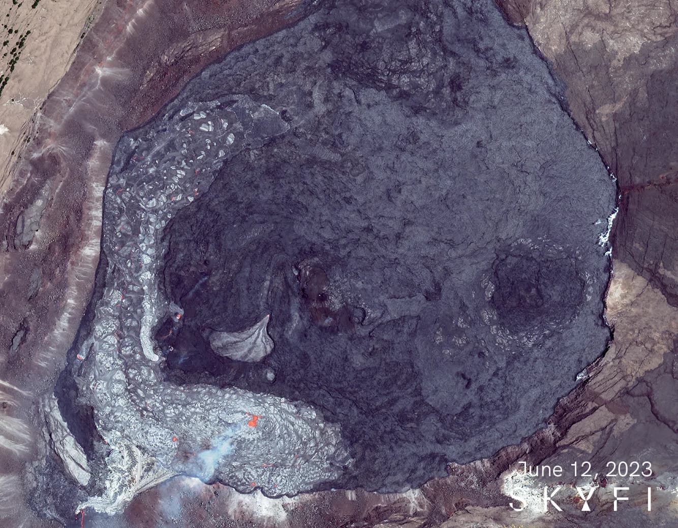
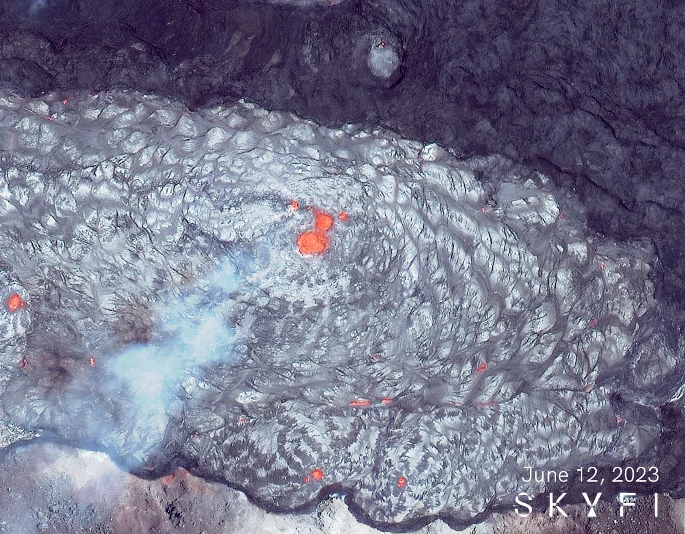
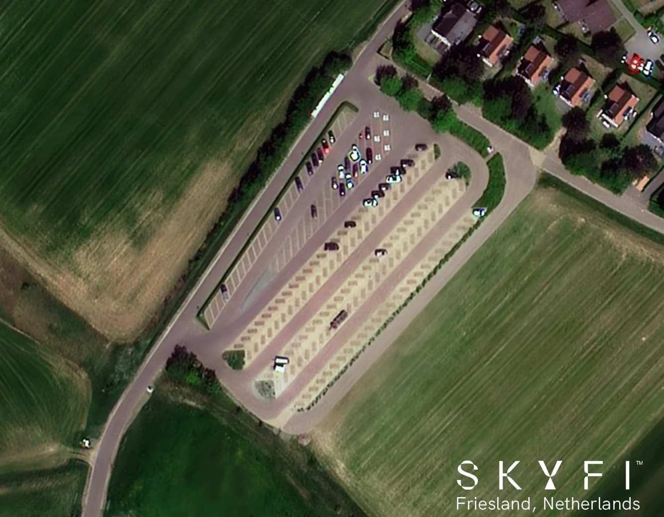
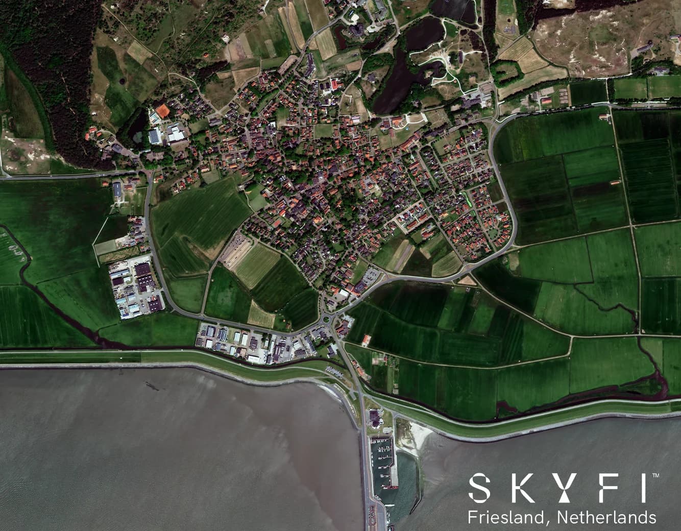
Your requests for higher resolution imagery have been heard, and we are thrilled to announce the release of 30 cm resolution for New and Existing imagery on the SkyFi app! This exciting upgrade brings you even closer to the ground, allowing you to explore and analyze the world from space with unparalleled detail and precision.
A New Era of Clarity and Insight
With the introduction of 30 cm imagery, SkyFi is pushing the boundaries of satellite imaging technology. Whether you are a researcher, analyst, or enthusiast, this advancement opens up a world of possibilities for extracting valuable insights from the Earth's surface. From urban planning to infrastructure management, environmental monitoring to disaster response, the enhanced clarity offered by our Super High Resolution imagery empowers you to make better-informed decisions.
Empowering Industries with Precision
From agriculture to forestry, environmental conservation to civil engineering, the availability of Super High Resolution imagery on the SkyFi app will revolutionize various industries. Farmers can monitor crop health at a subfield level, identify irrigation needs, and optimize yield. Conservationists can assess the impact of human activity on fragile ecosystems and devise targeted preservation strategies. Engineers can inspect infrastructure with a level of detail that was previously unimaginable, ensuring safety and efficiency in their projects.

Your Gateway to Unrivaled Detail
At SkyFi, we remain dedicated to delivering cutting-edge imagery solutions that empower you to unlock the full potential of geospatial data. The 30 cm imagery represents a significant milestone in our ongoing commitment to providing you with the tools and insights needed to navigate a complex and rapidly changing world.
Experience the future of satellite imaging. Upgrade to Super High Resolution imagery on the SkyFi app today and see the world like never before. Enter the app now!